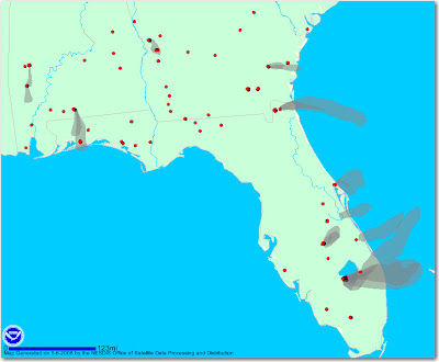
NOAA is now generating maps that not only show heat from vegetation fires detected by satellites, but now they have maps that show graphic depictions of smoke plumes from fires. On the map below, the red dots are heat sources, but not all are necessarily vegetation fires. The gray smoke plumes are visible from the larger fires.
Florida has a number of fires going including two fires that burned together forming a 3,500 acre fire that is burning grass islands in Lake Okeechobee. Arson is suspected as the cause of those fires. The names of the fires are "Myakka Cut" and "Grassy Island".
Below is a photo of the fire on a grass island in Lake Okeechobee. Photo courtesy of CBS.
How to Use Depth of Market Charts to Predict Price Movements
-
In the fast-paced world of trading, understanding market dynamics can make
all the difference between profit and loss. Among the myriad tools
available t...
1 day ago
No comments:
Post a Comment