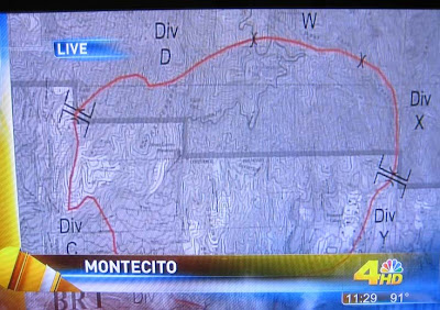
The quality of these images photographed from a television is not great, but here they are. The TV crew shot video of them on the wall at the Incident Command Post. We believe the boundary that zig-zags east/west across the map is the border of the Los Padres National Forest, with the forest being on the north side of the line. At the very bottom of the second map are the cities of Montecito and Santa Barbara.
At the top-center of the first map you can barely make out Gibraltar Road that goes roughly north out of Santa Barbara up into the National Forest past Rattlesnake Canyon Park.
We posted other maps and information about the fire in other posts
here,
here, and
here.
Click on the maps to see larger versions.


3 comments:
Good idea, need clearer pictures
I just posted this morning's thermal IR imagery- http://www.fireimaging.com/homepage.html
Thanks Robert. I included information about the imagery in a new post at: http://wildfiretoday.blogspot.com/2008/11/infrared-imagery-of-montecitos-tea-fire.html
Post a Comment