The Cold Springs fire has now been more accurately mapped at 7,160 acres and it is 5% contained. Crews and dozers began constructing fireline on the south, west, and east sides supported by heavy helicopters. Hot Shot crews that arrived today will be assigned to the night shift to take advantage of the lesser fire activity and cooler temperatures.
=====================================
2:15 p.m. PT
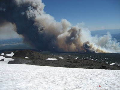
A climber on Mount Adams, Jennifer Walts, grabbed some great photos of the fire as she and 200 other hikers were being evacuated from the mountain as the Cold Springs fire was gathering up a head of steam yesterday.
I have never before seen, in a photo of a large fire, a large a snow field in the foreground. Looking at it, my head begins to hurt.... does not compute.
The fire, burning on the Gifford Pinchot NF in southwest Washington, has burned over 8,000 acres and is 0% contained.


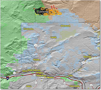
The map below shows heat, in red, orange, and black, detected by satellites last night and today, with the red areas being the most recently burned. Click on the map to see a larger version.


No comments:
Post a Comment