The ENPLAN Wildfire Viewer combines fire perimeters, MODIS satellite heat detections, and a Google map. It is updated many times a day, but only has data for northern California. It would be great if this were available for the whole nation.
Yesterday Wildfire Today covered the survival of the California condors through the Big Sur fires. The condor sanctuary facility burned in the Basin fire and the non-profit Ventana Wildlife Society is seeking donations to rebuild it. The Monterey County Herald has more information.
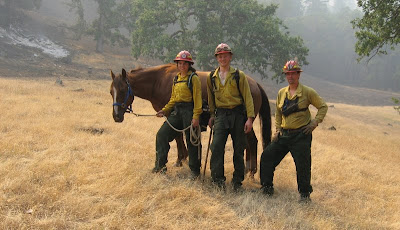
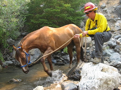
On Wednesday we covered the story of the horse that was rescued by a fire crew on the Mill fire, part of the Soda Complex on the Mendocino National Forest in northern California. We finally were able to dig up some photos. The horse is back with it's owner now.


Here is a video of the President's visit to Redding and the fires in northern California yesterday. It's a little raw, and almost 5 minutes, but it's pretty interesting. Notice the motorcade of 10-20 vehicles departing at high speed. They are traveling 700 yards from Air Force One to the smokejumper facility.
And speaking of the President's 747, Evergreen submitted their contract proposal for their 747 "Supertanker" to the U. S. Forest Service a week ago, but their Supertanker Sales Manager told us today that they have not heard back from the FS yet.
The Sacramento Bee has a story about "fire use fires", fires that are not totally suppressed, but are monitored and herded around. The SacBee of course refers to them as "let burn" fires, a term the federal land management agencies have hated ever since the fires of 1988 in the Yellowstone area.
The Monterey County Weekly has an interesting article about how residents in Big Sur during the Basin fire ignored evacuation orders and evaded law enforcement officers while protecting structures. I have a feeling that the comments at the bottom of the article are going to grow into a major discussion, with strong feelings on both sides of the issue.
UPDATE @ 1132 MT, July 18, 2008
As of late yesterday there was little fire activity on the Big Sur Basin fire with the exception of the burnout operation in the White Oaks area, east of Devils Peak, and near Tassajara Creek campground 1-2 miles southeast of the Tassajara Zen facility. The fire is 129,732 acres and is 65% contained. InciWeb is working today, for now at least:
Last night's burnout operations went well along Carmel Valley Road. Burnout operations are expected to extend southeast along the containment line as conditions permit, with units mopping up along Carmel Valley Road behind the fire.On the Cold Springs Fire in southwest Washington there was very little fire activity late yesterday--firefighters appear to be getting a handle on this one. Crews continue direct line construction in all divisions. One mile of line remains open. It is 7,933 acres and 30% contained.
Burnout operations will also proceed east of Devil's Peak on the north edge of the fire, and will continue in the coming days as conditions permit. The northern edge of the fire is backing slowly toward Carmel River inside the containment lines.


No comments:
Post a Comment